


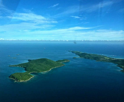
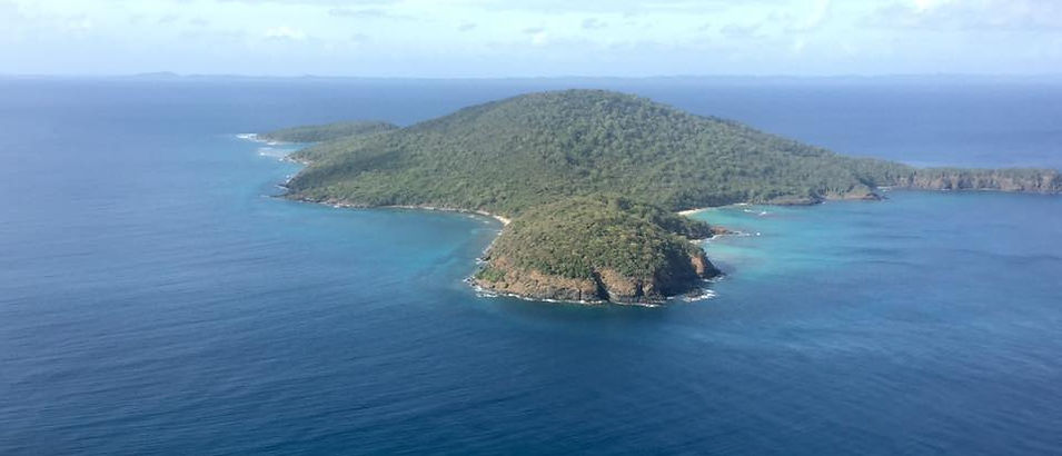
The Canal de Luis Peña Natural Reserve is located on the southwest coast of Culebra between the Flamenco Oeste Peninsula and Punta de Vapor (northwest of Luis Peña key), Punta Melones and Punta del Este (Luis Peña key).
The total area of the natural reserve is approximately 4.8 square km, (1,208 acres), from inland covering the land maritime public domain assets.
Within the legal system of Puerto Rico, the resources that make up the RNCLP are called common goods in the public domain.
Weather
Culebra is exposed to the continuous action of the Trade Winds, whose average speed is 16 km / h.
As there are no high-altitude mountains in Culebra, the moisture-laden ascent that comes from the sea is not generated and there is no rain as a result of these winds.
The rainy season recorded for Culebra extends from September to November, receiving between 25 to 30 inches.
During the winter the temperature fluctuates around 74 degrees F, during the summer the temperature rises to 92 degrees F.
Geography and physiology
The Culebra archipelago has a total area of 26.5 square km. From east to west it has a measurement of 7 miles, while from north to south it has a measurement of 3.5 miles.
It is characterized by an irregular topography with low elevation hills.
Its highest point is Monte Resaca, 190 meters or 610 feet above sea level.

Geology
Its geological deposits consist of material derived from volcanic bedrock.
Floors
In coastal areas, alluvial deposits are usually interspersed with coral sand, with clay and organic alluvial deposits in the mangrove and coastal lagoon areas.
Soil associations
-
Broken : The most abundant. Volcanic rock, has little capacity to retain water, is of low fertility, with slopes between 5 and 60%. Highly susceptible to erosion due to runoff waters.
-
Amelia : Deep, with good drainage and moderate permeability, its slopes are moderate between 12-20%.
-
Fraternity : It is located on the coastal plains and is made up of volcanic rock and calcite sediments. Slow drainage and low permeability. Natural fertility and high capacity to retain water, runoff waters run slowly. Deep, predominantly flat with slopes between 0 and 5%.
-
Jácana : It is made up of fine-textured sediments derived from basaltic volcanic rocks. Moderately deep, it has a moderately slow permeability. Generally flat, with a slope between 2 and 12% and has a neutral fertility.
-
Rocky Earth : Exposure of rocks in 50 to 60% of its surface. Some loose rocks can be seen on the surface. It is found in mountainous sectors with slopes between 60 and 70%.
-
Swampy Zone : located in the coastal plains, poor drainage, fluctuations in sea level increase soil salinity preventing the growth of other types of vegetation in the area.
Hydrology
In Culebra there are no rivers, streams or other sources of natural surface fresh water.
Bathymetry
The greatest depth recorded in the Canal Luis Peña Reserve is 24.4 m in the southern area near Cayo Luis Peña, the site called El Cayito Hondo, as well as the middle of the channel in front of Punta Melones.
Source: Designation Document (DNER, 1999) and Management Plan 2008